Pixley Refugefall & winter wildlife
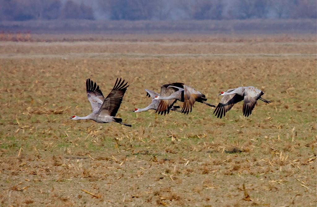
Wildlife refugeSandhill cranes roost at the refuge, up to 6,000 of them, per the Fish and Wildlife Service. No official report yet this season.
Sources for this timing ↓About Pixley Refuge
- What it is
- A wildlife refuge in California
- What you'll see
- Sandhill cranes · Sep–Mar
Next 7 days at Pixley Refuge
- TodaySunny97° / 58°–
- FriMostly Sunny97° / 61°–
- SatSunny99° / 63°–
- SunSunny100° / 65°–
- MonSunny99° / 63°–
- TueSunny98° / 63°–
- WedSunny98° / ––
Today: sunrise 6:53 a.m., sunset 6:43 p.m., light until 7:08 p.m. · moon waning gibbous, 66% lit (our calculation)
Your guide to the area
- Winter
Visitor points on this map: Entrance Observation Deck (15.7 mi) · Wildlife Observation Platform #2 (16 mi) · Kern Photo Blind (18.3 mi)
Places on this map, as a list
Where to watch
- Pixley National Wildlife Refuge TrailAn easy 1.5-mile natural-surface trail with 13 stops and wildlife viewing areas, open all year from sunrise to sunset (no bikes or horses). It starts at the gravel lot off Road 88, just north of Deer Creek
- Observation deck at the end of the trailLooks over areas you can't see from the ground; the refuge calls it a perfect place to watch cranes and ibis take to the sky at sunrise
Nearby
- Kern RefugeWildlife refuge16 miBirding is best on the refuge from October through MarchSatSunny
Worth the drive · more than 60 miles
- Merced RefugeWildlife refuge111 mimid-September to early MarchSatSunny
- San Luis RefugeWildlife refuge127 miJanuarySatSunny
- San Joaquin River RefugeWildlife refuge159 miOctober to MarchSatSunny
- Point ReyesSeashore246 miDecember through mid-February, with peak viewing in mid-JanuarySatPatchy Fog then Mostly Sunny
- San Diego RefugeWildlife refuge262 micommon in the bird list's Fall (September through October) and Winter (November through February) seasonsSatSunny
The year at Pixley Refuge
- Nature trail and observation deck open all year, sunrise to sunsetNowJan–Dec
- Shorebirds feed in the draining wetlands as spring migrants head northspring
- Sandhill cranes roost here from September through March (arriving from late September), up to 6,000NowSep–Mar
Pixley Refuge in pictures
Questions people ask
When is the best time to see wildlife at Pixley National Wildlife Refuge?
Sandhill cranes roost at the refuge, up to 6,000 of them, per the Fish and Wildlife Service: from September through March. That's general timing for this place, not a peak date or a forecast.
Is it wildlife season at Pixley National Wildlife Refuge right now?
There's no official report yet this season.
When is the best time to see the cranes?
The refuge says late winter and the early months of spring are best. Cranes start showing up in late September and roost here through March; at sunrise they fly out to feed, a good moment to be on the deck.Sources: U.S. Fish and Wildlife Service, Pixley NWR: Visit Us ↗ (opens in a new tab), U.S. Fish and Wildlife Service, Pixley NWR: Species ↗ (opens in a new tab)
Can I drive through the refuge?
No. The refuge is closed to all vehicles; park in the gravel lot by the trailhead and walk. Hiking is allowed only on the nature trail.Sources: U.S. Fish and Wildlife Service, Kern National Wildlife Refuge Complex brochure (PDF) ↗ (opens in a new tab), U.S. Fish and Wildlife Service, Pixley NWR: Visit Us ↗ (opens in a new tab)
How do I get there?
From Highway 99 at Earlimart, go west on Avenue 56 (Sierra Avenue) for 5.7 miles to the refuge sign just before Road 88, then north on Road 88 for about a mile until you cross Deer Creek; the gravel lot and trailhead are on the left (west). Trail guides are in the box by the sign.Source: U.S. Fish and Wildlife Service, Pixley NWR: Visit Us ↗ (opens in a new tab)
Is there hunting?
No. Pixley is closed to all forms of hunting.Source: U.S. Fish and Wildlife Service, Kern National Wildlife Refuge Complex brochure (PDF) ↗ (opens in a new tab)
Where are the best spots in Pixley National Wildlife Refuge?
Pixley National Wildlife Refuge Trail: an easy 1.5-mile natural-surface trail with 13 stops and wildlife viewing areas, open all year from sunrise to sunset (no bikes or horses). It starts at the gravel lot off Road 88, just north of Deer Creek; Observation deck at the end of the trail: looks over areas you can't see from the ground; the refuge calls it a perfect place to watch cranes and ibis take to the sky at sunrise.
What is Pixley National Wildlife Refuge like through the year?
Sandhill cranes roost here from September through March (arriving from late September), up to 6,000 (Sep–Mar), Nature trail and observation deck open all year, sunrise to sunset (Jan–Dec) and Shorebirds feed in the draining wetlands as spring migrants head north (Mar–May).
How we know · Sources (4)
How we know
National Weather Service forecast and alerts (opens in a new tab) (Oct 1) · U.S. Fish and Wildlife Service, Pixley NWR: Visit Us (opens in a new tab) (Sep 30) · U.S. Fish and Wildlife Service, Pixley NWR: Species (opens in a new tab) (Sep 30) · U.S. Fish and Wildlife Service, Kern National Wildlife Refuge Complex brochure (PDF) (opens in a new tab) (Sep 30)