Mississippi
When to catch Natchez Trace Parkway, Mississippiat its best
Natchez Trace Parkway, Mississippi through the year: wildflowers (local timing: early March through May, section by section) and fall foliage (local timing: from mid-October near Nashville to just before Thanksgiving near Jackson, Mississippi). Each has its own page with spots, sources and the latest reports.
About Natchez Trace Parkway, Mississippi
- What it is
- A National Park Service site in Mississippi
- A little history
- Dogwood Valley (milepost 275.5): Short trail about the natural history of mature hardwood trees
- What you'll see
- Wildflowers · Mar–MayFall foliage · Oct–Nov
- Before you go
- Is the Parkway Visitor Center near Tupelo open in the fall? Yes. It is open 9 a.m. to 4:30 p.m. every day, except Thanksgiving, December 25 and January 1.
RIGHT NOW · SEP 30
- Latest reportNo dated report this season; the posters below show each usual window.
- This weekend (NWS)Sat showers and thunderstorms likely, 83°F · Sun chance rain showers, 80°F
- Park alerts1 current NPS alert: Current Park Closures
When are you going?
Fall at Natchez Trace Parkway, Mississippi
- SEASON · FALL FOLIAGENatchez Trace Parkway, MississippiFrom mid-October near Nashville to just before Thanksgiving near Jackson, MississippiMississippi
From mid-October near Nashville to just before Thanksgiving near Jackson, Mississippi · National Park Service ↗
Also good in fall
- Leaf Peeping Along the Natchez Trace ↗In middle to late October, the maple, hickory, oak and other hardwood trees begin to change colors and visitors have the opportunity to view the brilliant fall foliage along the Natchez Trace Parkway.
From each place's own sources and the National Park Service; no peak claimed.
Winter at Natchez Trace Parkway, Mississippi
Nearby in winter
Spring at Natchez Trace Parkway, Mississippi
- SEASON · WILDFLOWERSNatchez Trace Parkway, MississippiEarly March through May, section by sectionMississippi
Early March through May, section by section · National Park Service ↗
Summer at Natchez Trace Parkway, Mississippi
Our sources name nothing here for summer; the other seasons above have what they do.
Where to go at Natchez Trace Parkway, Mississippi
- Fall
Visitor points on this map: Blackland Prairie section Northern Terminus Trailhead, Milepost 266 (1.3 mi) · Blackland Prairie Section Southern Terminus Trailhead, West Jackson Street (4.2 mi) · Visitor Contact Station and Administrative Office (5.4 mi) · Blackland Prairie section Northern Terminus Trailhead, Milepost 266 (1.3 mi) · Parkway Visitor Center, Milepost 266 (1.5 mi)
Places on this map, as a list
Best spots
- Chickasaw Village (milepost 261.8)Good for wildflowersA restored prairie with summer flowers; walk the Natchez Trace Trail through it, most variety near the roadNational Park Service ↗
- Cypress Swamp (milepost 122.0)Good for wildflowersWetland wildflowers, best in spring and early summer; watch for herons and alligatorsNational Park Service ↗
- Beech Springs Trail (milepost 266)Good for fall foliagePaved trail from the Parkway Visitor Center near Tupelo, with stops naming the plants of a hardwood forestNational Park Service ↗
- Old Town Overlook Trailhead (milepost 263.9)Good for fall foliageStart of a Natchez Trace Scenic Trail day hike to see the colors up closeNational Park Service ↗
- Dogwood Valley (milepost 275.5)Good for fall foliageShort trail about the natural history of mature hardwood treesNational Park Service ↗
- Little Mountain Overlook (milepost 193.1)Good for fall foliageQuick fall-color stop in the Jeff Busby CampgroundNational Park Service ↗
Next 7 days at Natchez Trace Parkway, Mississippi
- TodayPartly Cloudy– / 65°–
- ThuSunny92° / 71°6% rain
- FriPartly Sunny then Chance Showers And Thunderstorms90° / 68°60% rain
- SatShowers And Thunderstorms Likely83° / 65°63% rain
- SunChance Rain Showers80° / 61°50% rain
- MonSlight Chance Rain Showers then Mostly Sunny82° / 54°17% rain
- TueSunny81° / 57°2% rain
Heads up: Park closure: Current Park Closures.
Today: sunrise 6:49 a.m., sunset 6:42 p.m., light until 7:07 p.m. · moon waning gibbous, 78% lit (our calculation)
Visitor reports, not verified
Been here in the last week? Tell us how the trees looked.
What color were the trees?
Tap the one that looks most like what you saw.
One report per place for each day you saw it, no name or email · How reports work · Terms · Privacy
Plan your visit
Things to do
- Become a Natchez Trace Junior RangerDo you care about exploring, learning about, and protecting the Natchez Trace? If yes, become a Junior Ranger! There are many ways to be a Junior Ranger badge at Natchez Trace Parkway, and this fun activity book is a great place to start.
- Hiking the Blackland Prairie Section of the Natchez Trace National Scenic TrailThe Blackland Prairie section of the Natchez Trace National Scenic Trail is a popular 6 mile hiking trail in and around Tupelo, Mississippi.
- Hiking the Yockanookany Section of the Natchez Trace National Scenic TrailNorth of Jackson, Mississippi the Yockanookany section of the Natchez Trace National Scenic Trail is the longest of the five developed trail sections at 26 miles. Eight miles run alongside the Ross R. Barnett Reservoir, and the other sixteen miles go through dense forests, seasonal streams and open pastureland.
- Hiking the Highland Rim Section of the Natchez Trace National Scenic TrailThe Highland Rim section of the Natchez Trace National Scenic Trail is a popular twenty mile hiking and equestrian corridor south of Nashville Tennessee along the Natchez Trace Parkway from Milepost 427.4 to 407.9.
- Birding on the Natchez Trace ParkwayBirding on the Natchez Trace Parkway
- Campgrounds on the Natchez Trace ParkwayThe Natchez Trace Parkway manages three campgrounds along the length of the 444-mile Parkway. The three Parkway campgrounds are free, primitive, and available on a first come, first serve basis. They do not offer electricity, showers, or dump stations. The maximum stay at our campgrounds is 14 days combined throughout the year.
- Tent Camping on the Natchez TraceThe Natchez Trace Parkway manages three campgrounds along the Parkway. Those campgrounds are Meriwether Lewis at Milepost 385.9, Jeff Busby at Milepost 193.1 and Rocky Springs at Milepost 54. The campgrounds are free, primitive, and available on a first come, first serve basis. The maximum stay at our campgrounds is 14 days combined throughout the year. All camping must take place within designated campgrounds. The Natchez Trace Parkway does not allow dispersed camping.
- Hiking to Waterfalls on the Natchez TracePerhaps two of the most awe-inspiring sites along the Natchez Trace Parkway are Jackson Falls (milepost 404.7) and Fall Hollow (milepost 391.9) located in Tennessee. Though both falls are equally picturesque, each fall offers a unique experience. Both provide beautiful scenery, but also offer opportunities to see wildflowers, birds, and other wildlife.
- Earn a BARK Ranger Dog TagHEY DOGS!!! Do you want to proudly wear the BARK Ranger dog tag? We made it easy for a human to help you get one, and you both can have fun while earning it.
- Trails on the Natchez Trace ParkwayThe Natchez Trace Parkway has trails from 200 feet to 27 miles long. There are many short nature trails, and the Natchez Trace National Scenic Trail (www.nps.gov/natt) is totally contained within the Parkway boundaries.
- Hiking the Natchez Trace National Scenic TrailThe Natchez Trace National Scenic Trail consists of five sections running roughly parallel to the Natchez Trace Parkway motor road. The five sections of hiking trail, total more than 60 miles in southern forests. The trails offer opportunities to explore wetlands, swamps, hardwood forest, rock outcroppings, overlooks, and the history of the area. Established in 1983, the trail is part of the National Park Service and the National Trails System.
- Hiking the Potkopinu Section of the Natchez Trace National Scenic TrailPotkopinu (Pot-cop-i-new), the southernmost section of the Natchez Trace National Scenic Trail, is only three miles long, but it is the longest stretch of "sunken" historic Trace remaining. Named for the Natchez word meaning "little valley." Thus trail cuts deep into the rich, fine-grained soil. It doesn't take much to erode this type of soil, and centuries of human and animal traffic have done an impressive job. This trail has some embankments over twenty feet high!
Worth the drive, and when they peak
- USUAL PEAK · FALL FOLIAGENoxubee RefugeNovember: … Peak of fall colors73 mi
“November: … Peak of fall colors” · U.S. Fish and Wildlife Service ↗
- USUAL PEAK · TEAL AND SONGBIRDSWheeler RefugeApril: Teal migration is at its peak.103 mi
“April: Teal migration is at its peak.” · U.S. Fish and Wildlife Service ↗
- SEASON · FALL FOLIAGENatchez Trace ParkwayMid- to late October105 mi
Mid- to late October · National Park Service ↗
Also nearby: Shiloh National Military Park 44 mi
Towns nearby
- Tupelo, MS4 mi
- Oxford, MS46 mi
- Starkville, MS60 mi
- Memphis, TN89 mi
- Jackson, TN92 mi
- Tuscaloosa, AL102 mi
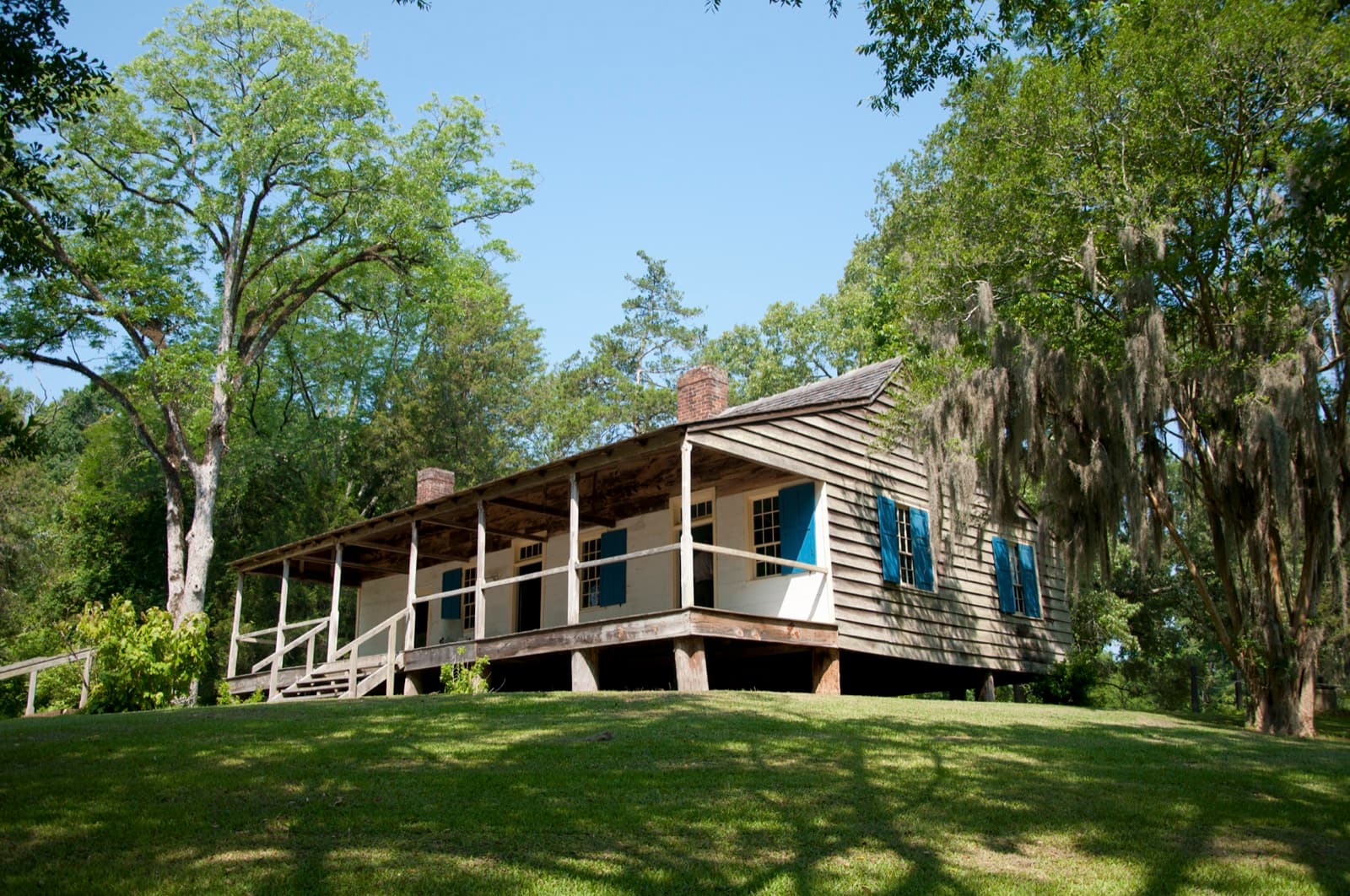
Natchez Trace Parkway, Mississippi in pictures
Questions people ask
Why does bloom timing change along the Parkway?
Flowers open in a wave from the Natchez end northward as the weather warms; the Natchez end blooms about two weeks to a month before the Nashville end. Spring flowers are usually out near Tupelo by early April.Sources: National Park Service, Finding Flowers on the Natchez Trace ↗ (opens in a new tab), National Park Service, Natchez Trace Parkway common wildflowers ↗ (opens in a new tab)
What's the best way to see them?
Walk one of the short trails (about 20 to 30 minutes); you see more variety than from the road.Source: National Park Service, Natchez Trace Parkway common wildflowers ↗ (opens in a new tab)
Can I pick the flowers?
No. All plants on the Parkway are protected; leave them growing.Source: National Park Service, Finding Flowers on the Natchez Trace ↗ (opens in a new tab)
When does the color reach Mississippi on the Natchez Trace?
The park says leaves normally start to change around mid-October at the northern end near Nashville, and the color works its way south to the Jackson area just before Thanksgiving. It also says the peak cannot be predicted, and it posts color reports every Friday in the fall.Sources: National Park Service, Leaf Peeping Along the Natchez Trace ↗ (opens in a new tab), National Park Service, Natchez Trace Parkway fall colors ↗ (opens in a new tab)
How we know
- Sep 27ReferenceWildflower waves by section; northern (Tennessee) section late March to early JuneSource (opens National Park Service, Finding Flowers on the Natchez Trace in a new tab)
- Sep 27ReferenceHardwoods change in middle to late October; Metal Ford and Swan View Overlook stopsSource (opens National Park Service, Leaf Peeping Along the Natchez Trace in a new tab)
- National Park Service sources: no claim to original U.S. Government works.