State guide
When to catch Arizonathrough the year
The peaks we can name in Arizona each belong to a place, not the whole state. Spring migration at Bill Williams River: late April to early May; Waterfowl at Bill Williams River: winter.
When are you going?
Fall in Arizona
- USUAL PEAK · FALL FOLIAGESan Francisco Peaks, Cave Creek Canyon, Escudilla MountainIn October at 3 Arizona placesArizona
“throughout the month of October” · US Forest Service ↗
Also good in fall
- Bill Williams River RefugeFall waterfowl arrive on the lake: goldeneyes, scaup, mergansers and wigeons
- Cave Creek CanyonBigtooth maple color
- Cibola RefugeWestern Canada geese: listed as abundant in fall and winter, September–February (refuge bird checklist, 2016)
- Escudilla MountainWildflowers on the Mogollon Rim
- Grand Canyon South RimHoary tansy aster blooms between July and October
- Mingus MountainThe mountain's plants (cacti, yuccas and agaves among ponderosa pines) are worth seeing any time from May through October
From each place's own sources; no peak claimed.
Winter in Arizona
- SEASON · WILDFLOWERSOrgan Pipe CactusBetween February and AprilArizona
“between February and April” · National Park Service ↗
Also good in winter
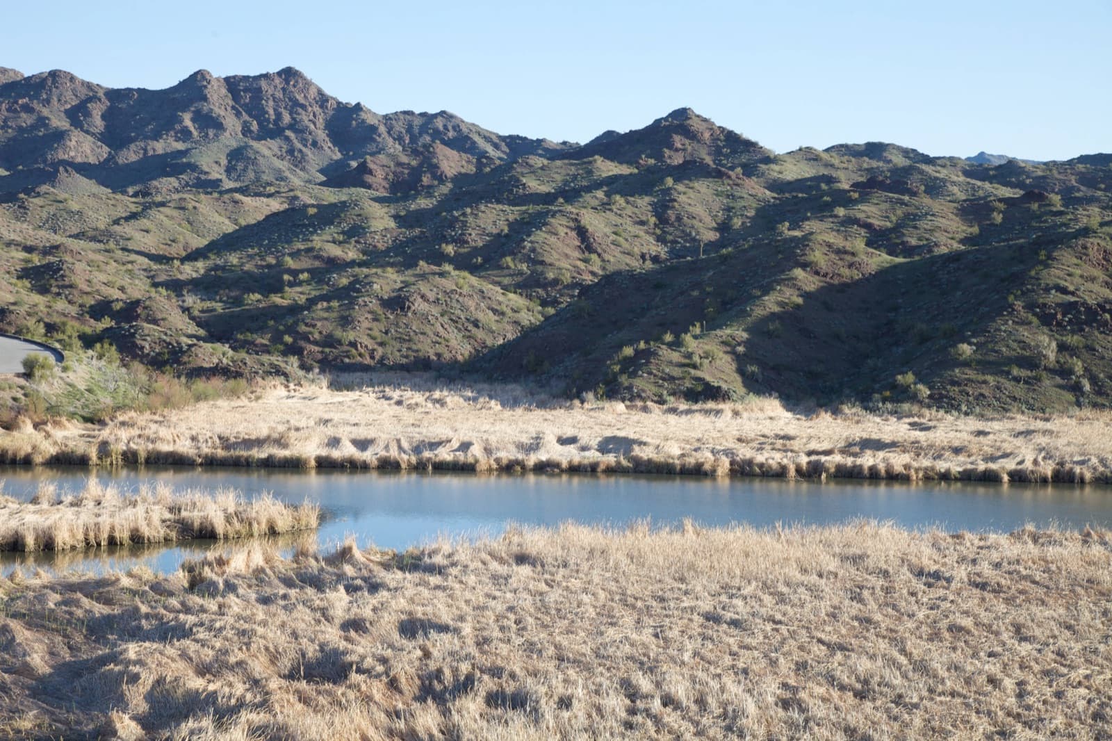
- Bill Williams River RefugePeak season for waterfowl (winter): large rafts of diving ducks and several kinds of grebes from the headquarters trails
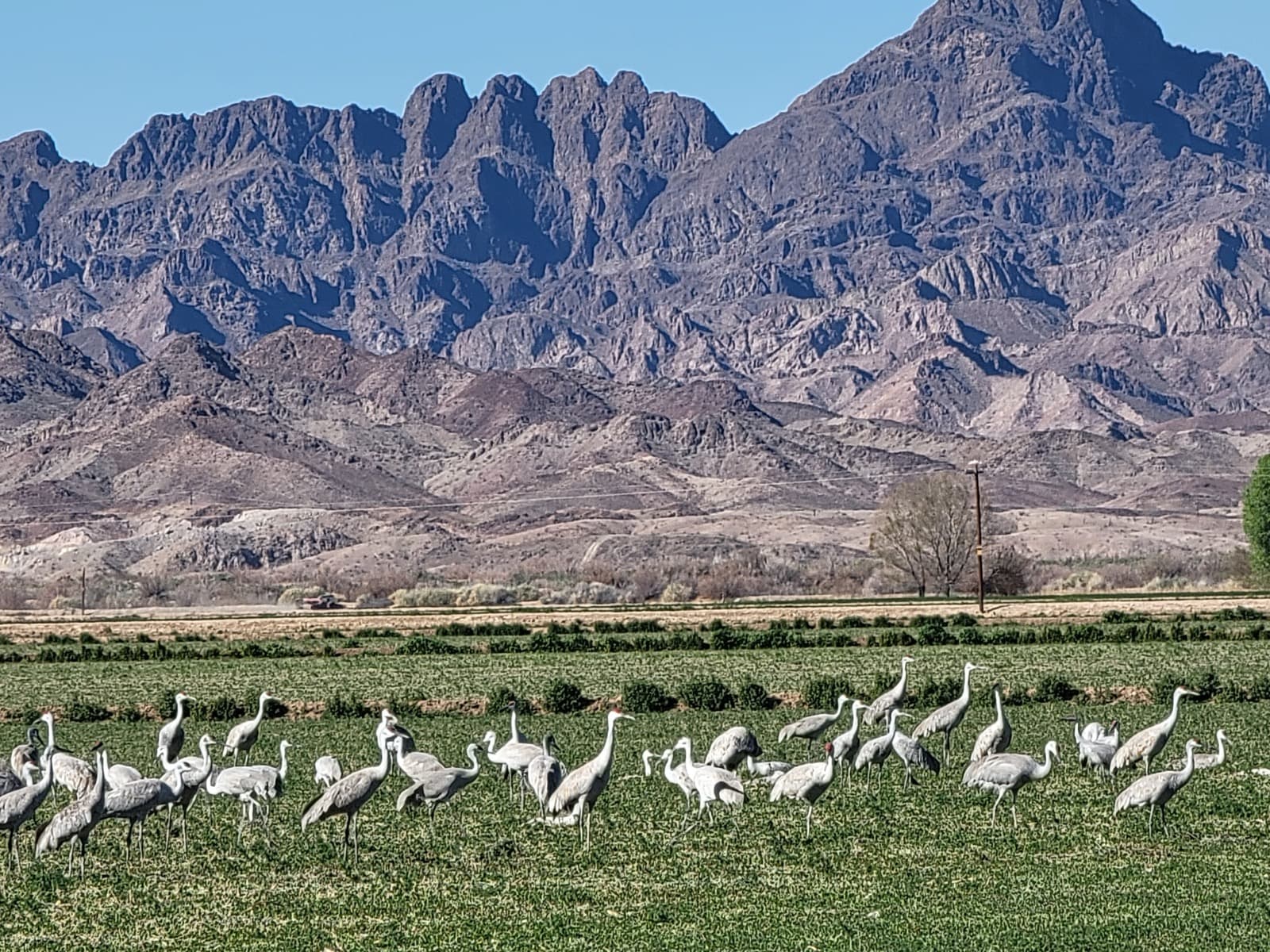
- Cibola RefugeWintering sandhill cranes, December–February (refuge bird checklist, 2016)
- Grand Canyon South RimQuieter paths in January and February, after the December holidays
- Organ Pipe CactusFree ranger programs, December through mid-April
- SaguaroBusiest months at the park, November to March
- TontoUpper Cliff Dwelling guided tours, weekends, November to April
From each place's own sources; no peak claimed.
Next peak here after winter
“throughout the month of October” · US Forest Service ↗
Spring in Arizona
- SEASON · WILDFLOWERSGrand Canyon South RimFlowers from May through SeptemberArizona
“Flowers from May through September” · National Park Service ↗
- More wildflowers:Saguaro
Also good in spring
- Bill Williams River RefugeSpring songbird migration at its peak, late April to early May
- Escudilla MountainSpring wildflowers
- Grand Canyon South RimDesert phlox blooms from April till July, on both sides of the canyon
- Organ Pipe CactusMexican gold poppies flower between February and April
- SaguaroSpring wildflowers are often best mid-late March
- TontoHedgehog cactus blooms bright pink in March and April
From each place's own sources; no peak claimed.
Next peak here after spring
“throughout the month of October” · US Forest Service ↗
Summer in Arizona
- SEASON · WILDFLOWERSMingus MountainJuly and August, after the summer rainsArizona
“July and August, after the summer rains” · US Forest Service ↗
Also good in summer
- Bill Williams River RefugeNesting season for Bell's vireo, summer tanager, yellow-billed cuckoo and southwestern willow flycatcher (summer)
- Cibola RefugeEarly fall migration for shorebirds and flycatchers, mid-July to mid-September
- Escudilla MountainPeak wildflowers
- Grand Canyon South RimThickleaf penstemon flowers from May through September
- Mingus MountainThe mountain's plants (cacti, yuccas and agaves among ponderosa pines) are worth seeing any time from May through October
- SaguaroSummer flower season, June to September
From each place's own sources; no peak claimed.
Next peak here after summer
“throughout the month of October” · US Forest Service ↗
Places in Arizona
- Spring
- Summer
- Fall
- Winter
Places on this map, as a list
- Bill Williams River RefugeLocal timing: late April to early May
- Cibola Refuge3 separate phases, from mid-July to mid-September
- Grand Canyon South RimLocal timing: Flowers from May through September
- San Francisco PeaksUsually throughout the month of October
- Mingus MountainLocal timing: July and August, after the summer rains
- Tonto2 separate phases, from March and April
- Spring
- Fall
- Winter
Places on this map, as a list
Colorado River
Southern Arizona
White Mountains
Planning a Arizona trip
Towns to stay in
- Phoenix, AZMingus Mountain · 77 mi
- Tucson, AZSaguaro · 20 mi
- Gilbert, AZSaguaro · 80 mi
- Goodyear, AZOrgan Pipe Cactus · 93 mi
- Flagstaff, AZSan Francisco Peaks · 8 mi
- Maricopa, AZSaguaro · 72 mi
- Marana, AZSaguaro · 15 mi
- Prescott Valley, AZMingus Mountain · 13 mi
- Sierra Vista, AZSaguaro · 70 mi
- Bullhead City, AZBill Williams River Refuge · 63 mi
- Kingman, AZBill Williams River Refuge · 64 mi
Nearest place we follow, straight-line miles.
Current park alerts (NPS)
- Grand Canyon South Rim: Overnight Lodging Suspended and Parkwide Stage 4 Water Restrictions ↗
- Grand Canyon South Rim: INNER CANYON TRAIL CLOSURES ↗
- Organ Pipe Cactus: Temporary Road Closures in Effect ↗
- Organ Pipe Cactus: Feral Dogs May Be Seen in Organ Pipe Cactus National Monument ↗
- Saguaro: Javelina Wash near Red Hills Visitor Center closed for safety ↗
- Saguaro: Loop Drive closed in Tucson Mountain District due to storms. ↗
- Tonto: Water is Required ↗
Browse by season and event
- Spring migration · 1 place hereSpring migration, everywhere →
- Fall foliage · 3 places hereFall foliage, everywhere →
- Winter wildlife · 1 place hereWinter wildlife, everywhere →
- Wildflowers · 5 places hereWildflowers, everywhere →
Questions people ask
Does it cost anything to visit at Bill Williams River Refuge?
No, there is no charge to visit.Source: U.S. Fish and Wildlife Service, Bill Williams River NWR: Visit Us ↗ (opens in a new tab)
What are the hours at Bill Williams River Refuge?
Refuge lands, roads and trails are open all year from half an hour before sunrise to half an hour after sunset. The visitor center is open Monday to Friday, 9 a.m. to 4 p.m., and closed on federal holidays.Source: U.S. Fish and Wildlife Service, Bill Williams River NWR: Visit Us ↗ (opens in a new tab)
When do the maples turn in Cave Creek Canyon?
In October and November. The Forest Service says visitors then get the fall color of Rocky Mountain bigtooth maples at Maple Camp on the South Fork of Cave Creek, and that the October leaves are gold and scarlet, especially around Maple Camp.Sources: Coronado National Forest, Burro Trail #240 ↗ (opens in a new tab), Coronado National Forest, South Fork Trail #243 ↗ (opens in a new tab)
Can I get there in a regular car at Cave Creek Canyon?
To the South Fork, yes: from Portal take FR 42 about 2 miles to the South Fork turnoff, and the Forest Service says all these roads suit passenger cars. The Burro Trail's Horseshoe Canyon road (FR 314) is different: 12 miles of 4-wheel-drive road. FR 42 and 42B can close for snow, floods or fire danger.Sources: Coronado National Forest, South Fork Trail #243 ↗ (opens in a new tab), Coronado National Forest, Burro Trail #240 ↗ (opens in a new tab), Coronado National Forest, Cave Creek Canyon recreation guide (2022) ↗ (opens in a new tab)
Can I visit Cibola Lake in winter?
No. Cibola Lake is closed to all entry from October 1 to March 14. From March 15 to September 30 it's open sunrise to sunset.Source: U.S. Fish and Wildlife Service, Cibola NWR: Visit Us ↗ (opens in a new tab)
Is the Escudilla Trail safe after the fire?
The Escudilla Wilderness was hit hard by the 2011 Wallow Fire. It's open, but the trails may not have been checked or maintained for fire hazards.Source: US Forest Service, Escudilla National Recreation Trail ↗ (opens in a new tab)
Nearby state guides: Nevada · Utah · New Mexico · Colorado
Arizona in pictures
How we know
- Sep 29Park ServiceSeasons of wildlife: spring songbird migration peaks late April to early May; summer nesting songbirds and reptiles; fall and winter waterfowlSource (opens U.S. Fish and Wildlife Service, Bill Williams River NWR: Species (Seasons of Wildlife) in a new tab)
- Sep 27Park ServiceBigtooth maple color in October or November at Maple Camp on the South Fork of Cave CreekSource (opens Coronado National Forest, Burro Trail #240 in a new tab)
- Sep 27Park ServiceBirding trail; Rocky Mountain maples gold and scarlet in October near Maple CampSource (opens Coronado National Forest, South Fork Trail #243 in a new tab)
- Sep 29Park ServiceRefuge bird checklist with seasonal abundance codes, the fall-migration timing note and the winter season legendSource (opens U.S. Fish and Wildlife Service, Birds of Cibola National Wildlife Refuge (checklist, through July 2016) in a new tab)
- Sep 27Park ServiceAspen color around the first week in OctoberSource (opens US Forest Service, Escudilla National Recreation Trail in a new tab)
- Sep 29Park ServiceCommon wildflowers at Grand Canyon, with where and when each bloomsSource (opens National Park Service, Grand Canyon National Park: Wildflowers in a new tab)
- National Park Service sources: no claim to original U.S. Government works.
Show all 11
- Sep 29ReferenceWildflower viewing area on the Prescott National Forest: best months, vegetation, lightning safety and directionsSource (opens US Forest Service, Celebrating Wildflowers: Mingus Mountain in a new tab)
- Sep 29Park ServiceThe monument's common wildflowers, including when Mexican gold poppies bloom and what a super bloom needs.Source (opens National Park Service, Organ Pipe Cactus National Monument: Wildflowers in a new tab)
- Sep 29Park ServiceThe park's three flowering seasons (spring flowers, cactus flowers, summer flowers) and what blooms in each.Source (opens National Park Service, Saguaro National Park: Flowers in a new tab)
- Sep 27Park ServiceColor often starts in late September and peaks through October; Flagstaff's high country is at its prime in early OctoberSource (opens US Forest Service, Coconino National Forest fall colors in a new tab)
- Sep 29Park ServiceSpring wildflowers and cactus bloom months at Tonto, with common species and their bloom seasonsSource (opens National Park Service, Tonto National Monument: Wildflowers in a new tab)
- National Park Service sources: no claim to original U.S. Government works.